 Hot Deals
 Shopfinish
 Shop
Shop Appliances
 Babies & Kids
 Best Selling
 Books
Books Consumer Electronics
 Furniture
 Home & Kitchen
 Jewelry
 Luxury & Beauty
 Shoes
Shoes Training & Certifications
 Wears & Clothings


News24 | Friday’s weather: Hot or cold? Freezing conditions, high fire risks expected in different parts of SA

Top Stories Tamfitronics
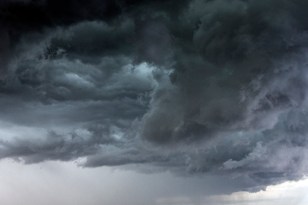
Freezing conditions and high risk of fires are expected in several different parts of the country. (Oliver Strewe/Getty Images)
It’s a mixed bag of persistent cold fronts with heavy downpours and extremely high fire danger conditions expected in different parts of the country, according to the South African Weather Service.
Impact-based warnings
A Yellow Level 4 warning for damaging winds expected along the coast between Lambert’s Bay and Mossel Bay has been issued by SAWS.
A Yellow Level 4 warning has been issued for damaging waves leading to difficulty in navigation at sea between Alexander Bay and Plettenberg Bay.
The service also announced a Yellow Level 4 warning for disruptive rain leading to localised flooding of roads and settlements over City of Cape Town, Swartland, Drakenstein, Stellenbosch and Theewaterskloof municipalities.
A Yellow Level 4 warning has been issued for damaging winds resulting in localised damage to settlements and difficult driving conditions over the southern parts of the Namakwa District Municipality in the Northern Cape, City of Cape Town, Cape Winelands, Overberg, Central Karoo and the western parts of the Garden Route district municipalities in the Western Cape.
There is also a Yellow Level 2 warning for damaging winds resulting in localised damage to settlements and difficult driving conditions in the Chris Hani District Municipality as well as the Senqu and Elundini local municipalities.
ROLLING COVERAGE |Western Cape’s weather woes continue, heavy rainfall forecast for Thursday afternoon
Fire danger warnings
Extremely high fire danger conditions are expected over the Emalahleni, Senqu and Sakhisizwe local municipalities in the Eastern Cape, Kagiso-Molopo Local Municipality in the North West and Mohokare Local Municipality in the Free State as well as Greater Letaba and Ephraim Mogale local municipalities in Limpopo and, lastly, Merafong City Local Municipality in Gauteng.
Advisories
A series of significant cold fronts are expected to persist, affecting the Western and Northern Cape until Sunday.
The public and small stock farmers are advised that intermittent heavy rainfall, snowfalls, very cold conditions, strong coastal and interior winds and very rough seas are forecast.
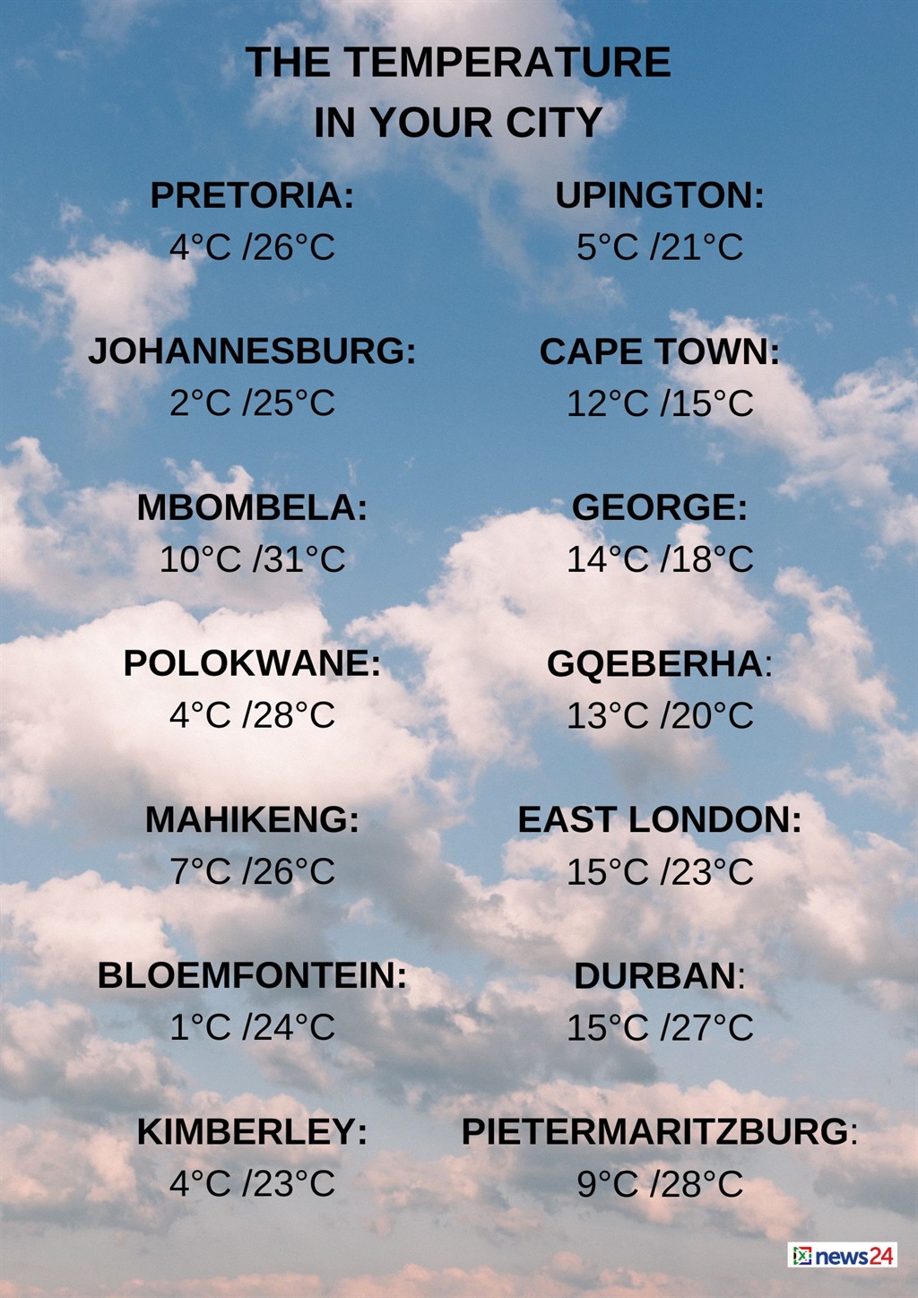
The weather in your region
Gauteng can expect fine and cool conditions, but it will be warm in the north.
The expected UVB sunburn index is very high.
Fine and warm temperatures are forecast in Mpumalanga and Limpopobut it will be hot in places in the Lowveld and Limpopo Valley.
The North West and the Free Statecan expect fine, windy and cool to warm conditions.
Cloudy and cold to very cold temperatures with light rain in the morning are forecast in the Northern Cape.
Otherwise, partly cloudy, windy and cool to warm conditions are expected, but it will be fine in the north-east.
The wind along the coast will be a moderate to fresh westerly to north-westerly, but strong at times in the morning.
The Western Cape will be partly cloudy and cool along the south coast and adjacent interior.
Otherwise, cloudy and cold conditions with isolated to scattered showers and rain in the west are expected, but it will be widespread in the south-west.
The wind along the coast will be a fresh to strong north-westerly, reaching gale force along the south-west coast.
The expected UVB sunburn index is low.
Cloudy conditions with isolated showers are forecast in the western half of the Eastern Cape’s south-west. Otherwise, it will be partly cloudy and cool.
The wind along the coast will be light and variable.
Fine and cool temperatures are expected for the eastern half of the province.
The wind along the coast will be a light north-westerly in the morning, otherwise a light and variable wind is forecast.
KwaZulu-Natal can expect fine and cool to warm conditions but hot temperatures are forecast in the north-east.
The wind along the coast will be a light to moderate south-westerly in the south.
Otherwise, a moderate to fresh northerly to north-easterly is expected, spreading to the south by evening.
The expected UVB sunburn index is high.
Discover more from Tamfis Nigeria Lmited
Subscribe to get the latest posts sent to your email.